Thursday, June 30, 2011

Queen St West & University Ave (WW1)


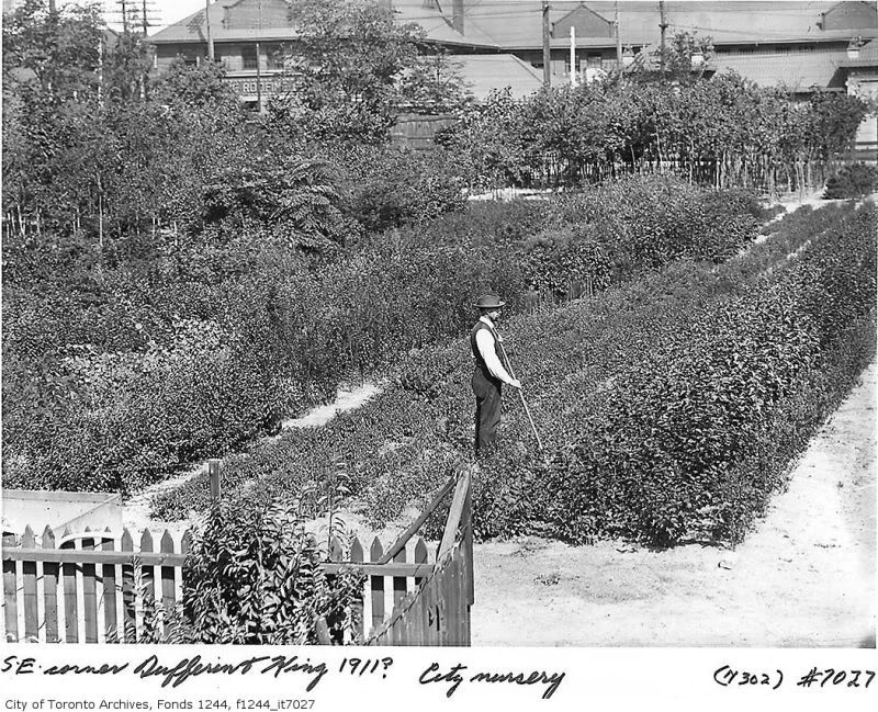
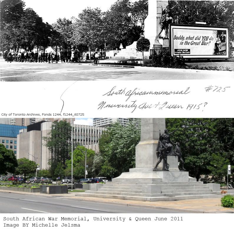
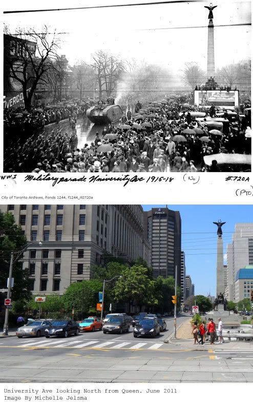
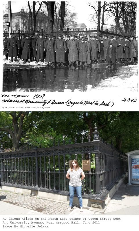
Sorry that I have been away, I have been enjoying the summer to its full extend. I wanted to make sure that I got another entry in before heading off to the cottage for the long weekend. Today I look at the intersection of University Ave and Queen Street West. This street got its name since it was the main route to the university at the north end of the city. The road for many years was very green and had an island with trees in the centre dividing the north and southbound lanes. This has been preserved with the islands which are still present today. Many have monuments to specific events and people who were important during their time of creation.

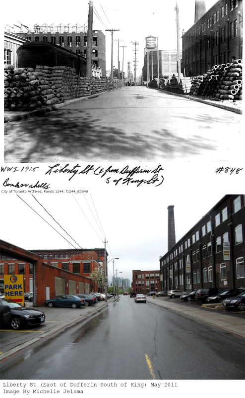
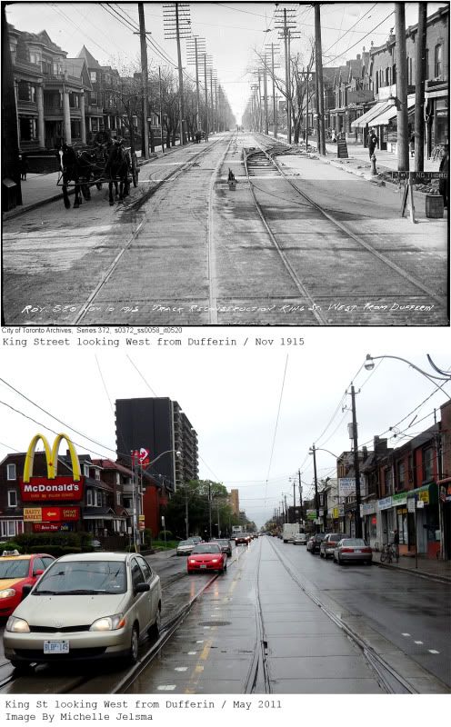
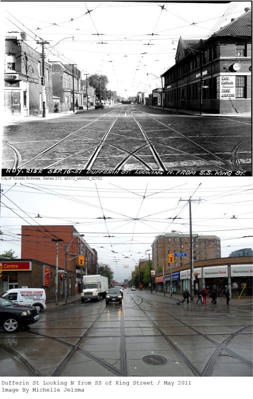
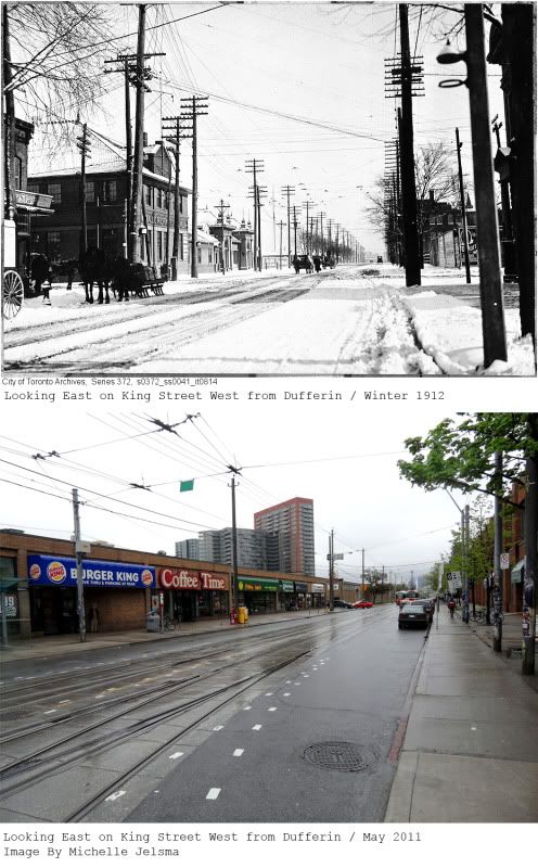
I really liked the images I found this week because they were set either during the First World War or right afterward. There are tanks, planes and cute military men in uniform. My good friend Alison came along with me to help photograph the various position the other day.

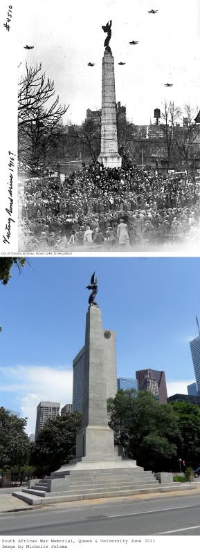
I am sort of chagrined to admit that I have passed the monument at Queen and University so many times and didn’t really know it’s name or what it stood for. It’s the one with the angel and I figured it was for one of the world wars. WRONG. This is the South African War Memorial (also known as the Second Boer War) which was built in 1908. It became a rallying point for the other wars to follow it seems. I think that my favorite image is the one asking “Daddy, what did YOU do in the Great War?” talk about a guilt trip.

Friday, June 10, 2011

St. James town


When I lived in the neighborhood I used to love to go for a walk to the St. James area, in the daylight of course. Parliament Street was named after the government buildings located near front street. The road was built on a trail that Governor John Graves Simcoe made to get to his summer home, fondly nicknamed Castle Frank after his son Francis Gwillim. This area was at the outskirts of the city and the family compact gave the un-favored residents of the city this land because it was uneven and hard to work.

I discovered Howard street when trying to make my way east from Yonge to Parliament. That is the street that is just south of the huge billboard you see when you exit the DVP at Bloor. There are a few large homes and you still get a feeling of what the neighborhood used to look like. As you can see from the images St. James Cemetery has been around for a while (1844), it is one of the oldest ones in Toronto and it is still in operation today. You can see that one of the out buildings (one I think they use for cremations) is still standing today on the south end of the property. It is also interesting to see what Wellesley looked like around 60 years ago. It almost looks a little idyllic in the 40’s, it is a shame now that this neighborhood has more of a sketchy feeling to it .

Friday, June 3, 2011

Christie Street Underpass

I selected this location because I was visiting a friend in the neighbourhood last week. We are going on vacation in two weeks and we had a clothes trying on session (shut up, I’m a girl, that is what we do). After searching the archives I found these two images and I liked how they are of the same spot a few years apart. One image when the train tracks were at street level in 1912 and one during the construction of the underpass in 1915 (or as they call it subway). This area has a lot of factories and I can imagine the construction of an underpass would have been of a great convenience to everyone. Christie Street was named after William Mellis Christie (aka Mr. “Christie, you make good cookies”). There used to be a Ford manufacturing plant, a planters peanuts factory, a TTC repair “barn” and a veteran hospital at this intersection back in the early 1900’s. Recently it is known as having the Loblaws which had the rodent infestation a few years back. There are quite a few of these underpasses in the city and what I really like are the murals that are on the walls. I really hope that no more murals are painted over in Mayor Ford’s bid to eliminate graffiti.

Thursday, May 26, 2011

King & Dufferin


Last week I had a job interview in the west end near Dufferin and King, where Liberty Village meets Parkdale. So I located a few interesting images off the Toronto Archive website for today’s blog post. In the past Liberty Village was known to have two things, manufacturing plants and prisons. Now? Condos and office buildings. Dufferin Street was named after Frederick Hamilton-Temple-Blackwood who was Lord Dufferin and King Street was named after King George III. I discovered that the south east corner of Dufferin and King was a Toronto nursery; there was a huge garden there for over 40 years. (See image below)

The first image series is one of my favorites, check out what is on Liberty Street… Bombs!!! Perhaps just bomb casings (I have never seen a real bomb so I can’t be sure). There was an artillery manufacturing plant on Liberty Street (which is located one block south on Dufferin) and I find it interesting that people now use that space to park their cars. You can see the Toronto Carpet Factory is being built in the background. That structure is beautiful, as are others in the neighbourhood.

For my readers who live in Parkdale you can see what it looked like before the area became apartment dominated. It is nice to see that a few of the original houses remain. Also interesting to discover that the CIBC on the North West corner has been such for at least 60 years.

Thursday, May 19, 2011

Yonge & Dundas


I would like to lament on two facts before I drop some knowledge.

#1 That every time I try to take before and after photos downtown it is raining! What gives? Here I am balancing my umbrella, my reference images and my camera. Plus let it be summer soon so I can shoot with some sun!

#2 Apparently people (in cars) have issues when I stand for long periods of time in the middle of the road during rush hour. LOL Must be members of the Rob Ford Nation. I’m creating art here people!

I dedicate this entry to the hard working employees at H&M Eaton Centre. Just when you thought you could escape work for the moment, I thought that it might be interesting to see what this familiar location in Toronto looked like in the roaring twenties. For those of you who are not familiar with Toronto this is the intersection of Dundas and Yonge. It has become the city’s Time square if you will but it wasn’t always like that. Dundas Street is named as such because it used to be the route that travelers would take to get to the town of Dundas in south western Ontario, much like Kingston road would take travelers to Kingston, Ontario. Yonge Street is Toronto’s “Main Street” if you will as it divides the city (East/ West) and is famous for being one of the longest roads in the world. Yonge has been a aboriginal trail and since John Simcoe Graves

I love reading the business signs on the old buildings, for instance the location which is now a “Forever 21” used to be the “United Cigar Store”. Also we can see a Laura Secord location, a Dentist office and a hair salon. The best two have got to be the “Beaver Billiards” and an “Aladdin’s Novelty Hosiery”. When looking at the before and after images I find it interesting to see what structures are located on the sites where the Eaton Centre and Dundas Square are currently located. To be honest my memory of what was located on the North and South East corner are a little vague. Funny how it has only been a couple years and things are starting to erase itself from my memory.

Friday, May 13, 2011

Don Mills


Unfortunately I was unable to get downtown this week to take pictures of Toronto landmarks. I live in Don Mills which is a suburb of Toronto and also happens to be Canada’s first planned community. I got really excited when I found old pictures of where I grew up; it was almost my very own “Back to the Future” flash back moment. I thought I would share them with you.

Pre WW2 my neighbourhood was isolated farm land, owned by the Milne family. You can find their old abandoned farm house in Charles Sauriol Park and their grave in Edwards Gardens. It was EP Taylor who bought up this land and turned it into iconic suburbia. Don Mills Rd and Lawrence Ave East is the centre of the community with the Donway circling it. Each quadrant was built to have a Church, a School and a network of park path systems so children didn’t have to walk across major roads. At the centre was the Don Mills mall and community centre and along the periphery of the community were the industrial buildings. I live in the North West quadrant which had the Library and Norman Ingram Public school.

The thing I love about Don Mills is that a majority of the remaining buildings have a Bauhaus/Googie style to them (Think iconic television 1950’s style with a twist of the Jetson’s). You can see this in the diamond pattern roof on the library. The inside of the library nowadays looks pretty good as they have made a few renovations; unfortunately the exterior has much to be desired because the original architecture is so hidden. The image with the tunnel is cute because I remember screaming my head off going through it, so I can picture those kids doing the same. I was interested and curious to also see how they eliminated so many windows in my elementary school. I guess they are trying to save money with heating. My favourite picture is the one where my house is depicted in a barren landscape and how much the foliage has taken over. It gives me hope when I look at all the planned communities springing up that they too could develop into something more.