Friday, March 25, 2011

The Grange

The Grange

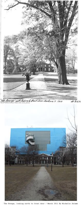
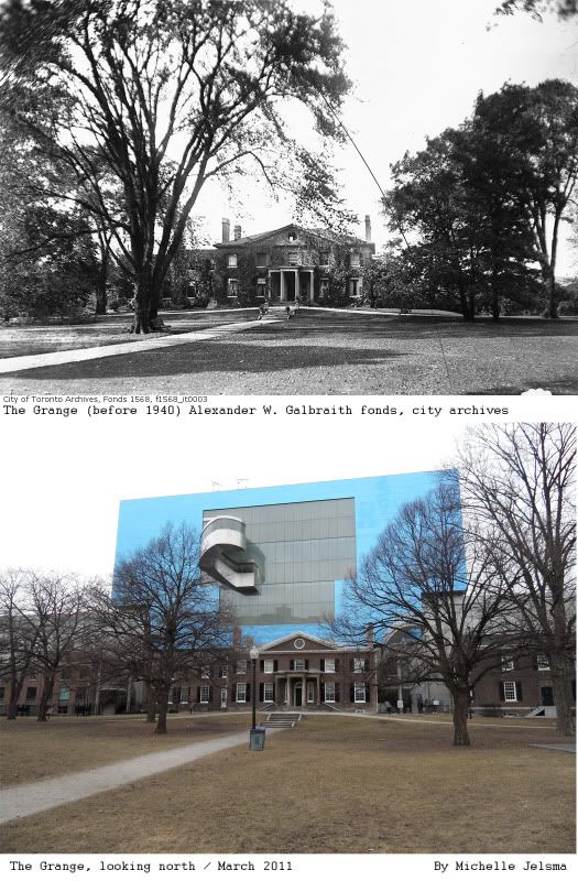
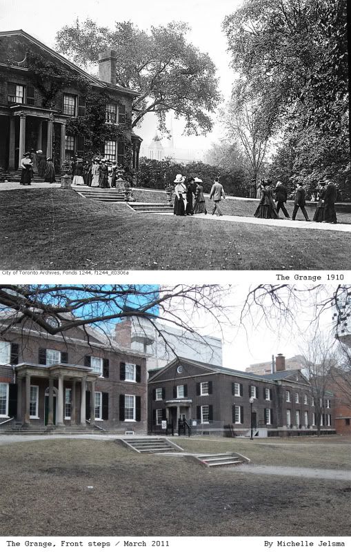
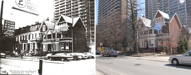
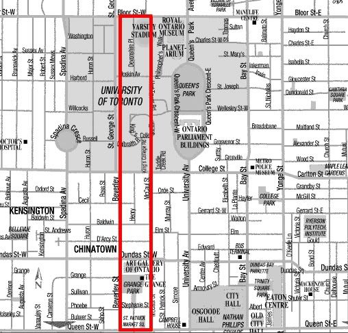
I went to the Ontario Collage of Art and Design (OCAD) from 2002 until 2006. The university is located at the corner of McCaul and Dundas Street West beside the Art Gallery of Ontario (AGO). I would often take walks in the park located beside the university and marvel at this old home known as “The Grange”. This building holds the title as the oldest stone building in Toronto as it was built in 1817, and it gets extra points for being in the location it was built. The property ran from Lot Street (Queen Street) until Bloor, in between Beverly and McCaul. It boggles the mind that people used to own so much property. I guess this is also why the city feels like it is cut in half at Bloor. The Grange was built for D’Arcy Boulton Jr. and his wife Sarah Anne. The would end up having eight kids and one of which would be William Boulton who ended up being the mayor of Toronto four times during the 1840’s. D’Arcy left the house to Sarah Anne, who then left it to her daughter in law Harriette. She married Goldwin Smith and they lived in the house until their death. The back end of their land was sold to friends so they could build a collage, which would eventually become the University of Toronto. The house got improved upon over the years and when the Smith’s died (1909-10) they left the house to the Ontario Society of Artist which turned the house into an art gallery and school.

Now here is where it gets interesting. The Boulton’s were a part of a group called “The Family Compact”. Charles Dickens called them a group prone to rabid Toryism, a society that were conservative, traditionalist and loyal to keeping the Church of England as the model for society. The Family Compact or “Tories” were based out of York (Toronto) and led by Bishop John Strachan. They controlled the government, which in turn meant that they controlled who got the land. They built churches which reflected their ideals and tried to restrict the building of Catholic, Presbyterian and Methodist buildings. The government would allot farms and tracks of land to the members of the Family Compact in the best parts of the city, while allocating difficult tracks of land and almost isolating farms to people who were not a part of this elite group. This is why the Boulton’s got such a large section of land in the city. This fight for land would eventually lead to the Upper Canada Rebellion.

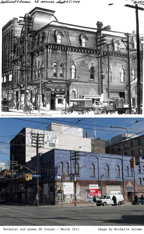
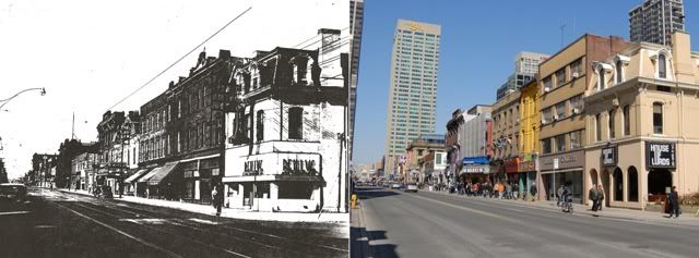
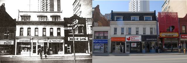
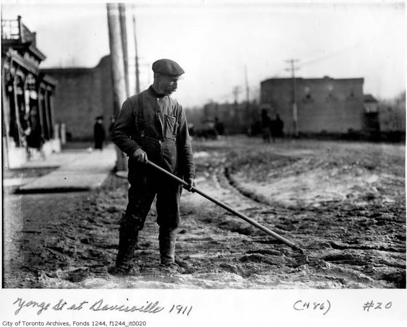
Looking at the pictures we can see the expansion of the house with the additions made by the collage to the east, as well as the new Frank O’Gehry addition to the AGO. Personally I do not like the blue paneling; it makes it look like it is still under construction and clashes with the Grange beneath. We can see that most of the original trees have been replaced and the ivy growing on the house has been removed. This park looks…. pretty nice in the summer time when the leaves have reappeared, so do not let the drab weather sway your opinion too much. I think my favorite image is the one with the people visiting the house. I wonder if it was for Smith’s Funeral or because people were visiting the new site for the art gallery. I love their hats and dresses; you really get a feel for the time when there are people in the image setting the tone. All in all I am very happy that this site is around for people to visit. It is a treasure that I am glad is being preserved for future generations.

Friday, March 18, 2011

Carlton and Church

Today we are visiting an intersection well known by many sports fans, Carlton Street and Church Street. The intersection is located in Toronto’s Garden District, so named because of its proximity to Allen Gardens. It is located at what is considered the southern edge of Toronto’s “Gay” village and close enough to Jarvis as to get the occasional hooker from Allen Gardens on the south east corner. It is home to Maple Leaf Gardens, what was once known for a while as the hub of the Hockey world. Now the stadium (a heritage site) is being converted into a grocery store and centre for Ryerson University’s’ sports programs.

However back before its creation the land was owned by Ann Wood the wife of Bishop Strachan, she donated the land above Gerrard Street for the creation of a road which she would have named after her brother Guy Carleton Wood. It was a dirt road for many years until plans were made to create a stadium in 1931 when it was determined by the city and TTC that it would be a valuable street for track to be laid as to assist with transportation. Church Street was named simply because the first church was located on this road down near the lakeshore. Many of the first major churches are located the base of this road which extends vertically through the downtown core.

I used to pass this intersection as I would go to and from work, and I noticed that the building on the south west corner (now a CIBC branch) had the words “Somerset House” written on its façade. I was always curious what the building used to be and I’m happy to finally discover its history. Built in the Richardsonian Romanesque style in 1895 by architect Frederick H Herbert it was the Somerset House Hotel. Herbert would build many of Toronto’s first brick homes, hotels and office buildings. Then in 1930 during the re-development of the area the building was remodeled by Langley & Howland to house the Imperial Bank of Canada (as is depicted in the images below).

On the North West corner in the vintage photographs you can see that they have started construction on Maple Leaf Gardens, It would not be completed until later that year. It was built in six months by Conn Smythe, who happened to be the Leafs managing director. It cost 1.5 million dollars to make, built on land purchased from the Timothy Eaton Co ltd. The Toronto Maple leafs would win 11 Stanley cups between the years of 1932–1967 in that building, including their first win in the first year of the buildings completion. Wrestling and boxing matches would also be held here as well as the first ever basketball game hosted by the Basketball Association of America (NBA). Elvis Presley played at the Gardens in 1957 in his first ever concert outside of America and the Beatles also played there three times from 1964-66. I would have loves to have been to either of those shows, I need a Delorian!

The only other building that I can tell is still present is in the 1931 image looking east. There behind the trees is the steeple of what appears to be St. Andrew's Evangelical Lutheran Church. What makes me a little sad is that street cars no longer run up and down Church Street unless it is when cars are being diverted or short turned. In fact the track has been removed north of Carlton Street, so I feel bad for the men putting the effort into laying the track in the 1931 images. It is a testament that this city is always changing.


Friday, March 11, 2011

Bathurst and Queen

Recently I went to Woolfits, the yarn store on Queen Street West. I decided to make the intersection of Queen Street West and Bathurst my next entry because a lot of the original buildings are still present. According to the first survey of York created in 1793 Queen Street was originally known as Lot Street up until 1837 when it was renamed to honour Queen Victoria. It was known as Lot Street because the land was divided up into lots along this main thoroughfare very similar to how New York City organized their layout. Bathurst Street is named after Henry Bathurst who was an Earl in England who organized migration to Canada after the war of 1812.

I was able to locate two images of this intersection on the Toronto archive’s website. It must be mentioned that the Toronto Transit Commission (TTC) kept excellent records of major intersections of the down town area when they were installing the street car tracks back in the 30’s.

On the north east corner we can see in this 1935 image what used to be the Imperial bank of Canada, a bank which eventually became the modern day CIBC. Now the structure has been renovated to suit another function which is common in Toronto as it is currently a Starbucks. The North West corner has a structure which was a Canadian Bank of Commerce location. This bank existed from 1867-1961 and interestingly it also merged into the modern day CIBC. This location is now St Christopher’s House where a large number of homeless individuals like to hang out.

The most dynamic change is shown in our second image comparison which is 651 Queen Street West. Located on the South East Corner of the intersection this building is most commonly referred to as The Big Bop. It was a very popular night club establishment from the 1980’s until just a year ago when it was sold to make way for a condo development. Now this purple building is boarded up and a bit of an eyesore. As you can see in the image taken in 1928 the roof is still intact in a style which is very common in Toronto. There was a United Cigar Store on the corner, a barber shop, maybe a travel agency and perhaps a furniture warehouse beyond that. It amazes me that a building can go through so much transformation over the years. I wouldn’t have known that there had been all those little shops in the front of the building if you were to look at it now. I also love to see the vintage cars and the people all wearing hats in these older images.

Tuesday, March 8, 2011

Yonge & Isabella

This was the corner where I used to live. I was fascinated to uncover what the neighborhood looked like in the past. From what I can tell Isabella was a residential street consisting of homes built between 1890's and 1920's. It developed between what was the town of Yorkville and the blossoming city of Toronto. Isabella runs from Yonge Street to Sherborne and for a time was broken between Church and Jarvis by what i believe was farm land, forest or a park. The first set of images are a comparison of Yonge street 1950's and 2009 the other two are from 1970's and 2009.


Welcome to my Toronto History Blog called The Muddy York. Here I will uncover the stories and secrets of the city I live in and love.