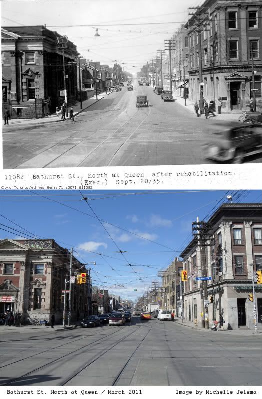
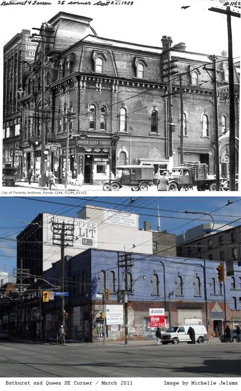
I was able to locate two images of this intersection on the Toronto archive’s website. It must be mentioned that the Toronto Transit Commission (TTC) kept excellent records of major intersections of the down town area when they were installing the street car tracks back in the 30’s.
On the north east corner we can see in this 1935 image what used to be the Imperial bank of Canada, a bank which eventually became the modern day CIBC. Now the structure has been renovated to suit another function which is common in Toronto as it is currently a Starbucks. The North West corner has a structure which was a Canadian Bank of Commerce location. This bank existed from 1867-1961 and interestingly it also merged into the modern day CIBC. This location is now St Christopher’s House where a large number of homeless individuals like to hang out.
The most dynamic change is shown in our second image comparison which is 651 Queen Street West. Located on the South East Corner of the intersection this building is most commonly referred to as The Big Bop. It was a very popular night club establishment from the 1980’s until just a year ago when it was sold to make way for a condo development. Now this purple building is boarded up and a bit of an eyesore. As you can see in the image taken in 1928 the roof is still intact in a style which is very common in Toronto. There was a United Cigar Store on the corner, a barber shop, maybe a travel agency and perhaps a furniture warehouse beyond that. It amazes me that a building can go through so much transformation over the years. I wouldn’t have known that there had been all those little shops in the front of the building if you were to look at it now. I also love to see the vintage cars and the people all wearing hats in these older images.


No comments:
Post a Comment