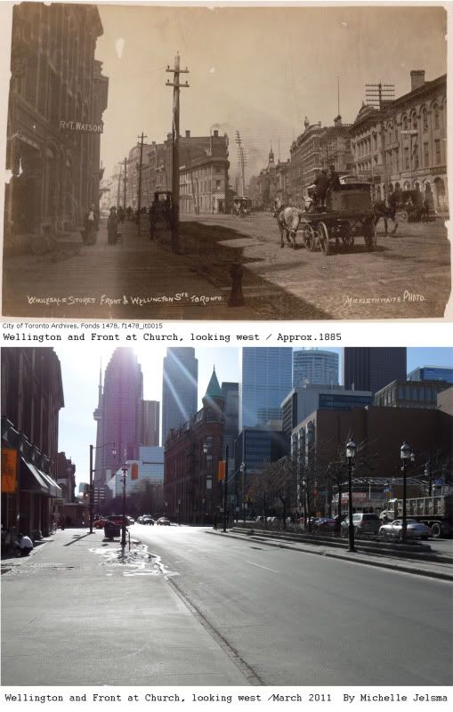
During the early 1800’s Travellers would be coming and going and there were a lot of hotels as a result. On the North West corner where the Pizza Pizza now stands was once a farm house built by Peter MacDougall in 1820, which was later remodeled by John Brown in 1829 into a hotel called Ontario House. Due to the influx of travelers the business prospered so well that they converted the building beside it as well, which was known as the Coffin Block due to its irregular shape. The building became the Wellington Hotel and on the bottom level of this building used to be where people could hire stage coaches for travel throughout Upper Canada.
Apparently the neighborhood resembled that of an old western town. With the multitude of hotels means that prostitution was prevalent. There were wooden sidewalks, stage coaches and to top it all off there were saloons as well. The distillery district is not that far away and in the days before water purification, the local water supply (Lake Ontario) was muddy and contaminated by peoples own filth. The only thing safe to drink was alcohol. Eventually the train tracks were laid south of this intersection on the Esplanade and a lot of the commuting traffic moved to Union Station. The hotels then closed down and this section of the city became more focused on factory work and office buildings. The Ontario House became the new location for The Bank of Toronto in 1860. The Wellington Hotel eventually was purchased by George Gooderham and became the head quarters for his business Gooderham and Worts. His family were experts at making good tasting beer and alcohol and this building provided him with a great view of his workers bringing his beer to the dock yards, trains and saloons in the neighbourhood. This Flatiron building is one of Toronto’s most unique structures due to its irregular designs.
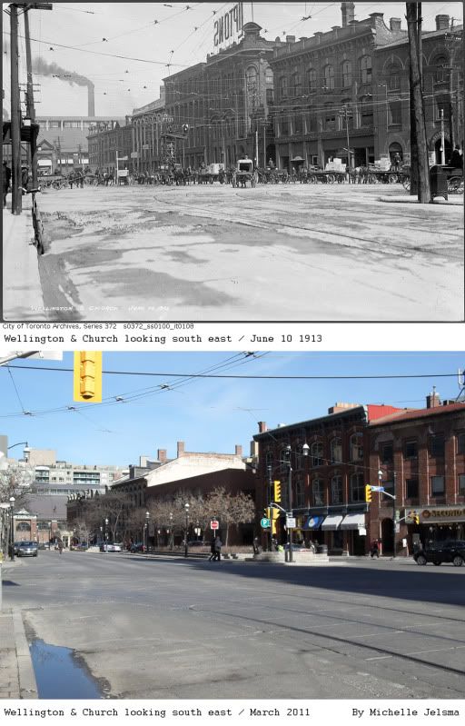
This neighbourhood is now very trendy, filled with Bristow’s, upscale store and condos. Only a few of the original buildings in the neighbourhood are the same. I must note that most of my wonderful information comes to me through articles written by local historian Bruce Bell. He gives walking history tours in the neighbourhood so if you are interested in learning more I suggest attending one.
It is a very profitable post for me. I've enjoyed reading the post. It is very informative and useful post. I would like to visit the post once more its valuable content.
ReplyDeleteretaining wall Wellington